As Crest Nicholson prepares to begin construction of a 763-home development in Harry Stoke (subject to final planning approval), a local history enthusiast is calling on the developer to preserve a historic water feature…
By Adrian Kerton
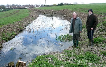
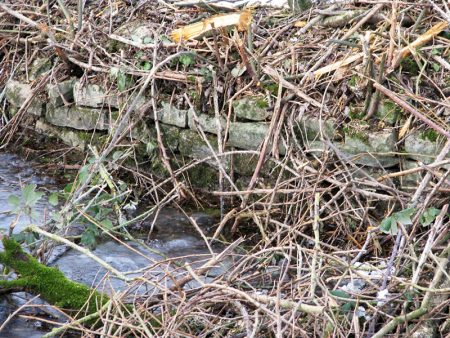
The ‘moat’ at Harry Stoke has always been regarded as an insignificant small pond, but now the surrounding scrub has been cleared, it can be seen to be a large, well engineered water feature, with an extensive dry stone wall. It is connected by an underground stone lined drain to the Stonelands pond, which is a breeding pond for the great crested newt, and as the two ponds are connected, it is probable that the moat is also a breeding pond.
So what is the purpose of the feature? A map of 1951 shows the designation as a ‘moat’, but the surrounding terrain suggests it never encompassed the early medieval settlement.
So what was it? We know that in 1304 John le White of Bristol sold a plot of land and a mill to Margaret Gifford, so was it the mill pond? Previous excavations haven’t shown the presence of a mill, but South Gloucestershire Council archaeologist Paul Driscoll has requested some exploratory trenches.
The other explanation is that the moat is a medieval fishpond.
“Like field-ponds, fishponds have not been seriously studied. Popular legend links them exclusively with monasteries and monastic properties, but in fact the fishpond was a useful adjunct to any village.” – B. K. Roberts, Medieval Fishponds, 1966
“Period fishponds are very representative of large scale animal husbandry during the medieval and post medieval period. As such they have considerable historic interest.” – Historic England (which lists more than 50 medieval fishponds as scheduled monuments)
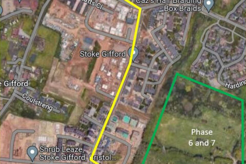
Medieval fishponds are usually rectangular, to aid their maintenance and managing of the fish. As the map shows, the Harry Stoke moat is indeed rectangular, though much of it has now been covered over.
The South Gloucestershire Biodiversity Action Plan recognises the importance such valuable features and highlights hedgerows, ponds and dry stone walls as local priority habitats and planning documents emphasise the need to bring a clear identity to the natural environment and to create a lasting contribution to the wider green infrastructure network and a recognition of the history and individual character of the local area. These ambitions will not be realised if the moat is filled in.
An opportunity also exists to uncover the rest of the moat and make it publicly accessible, which would be a superb educational opportunity to study the pond life throughout the year.
If readers would like to register their comments on this opportunity to save a unique historical and environmentally valuable asset, the planning application reference is PT17/5810/RM.
To find out more about the history of Stoke Gifford, including the Harry Stoke ‘moat’, visit my website at stokegiffordhistory.wordpress.com
See also: Land at Harry Stoke (The Journal)
Photos: 1 Adrian Kerton (right) and local resident David Shore at the ‘moat’. 2 Close-up photo of dry stone walling on the edge of the ‘moat’.
This article originally appeared in the April 2019 issue of the Stoke Gifford Journal magazine (on page 20). The magazine is delivered FREE, EVERY MONTH, to over 5,000 homes in Stoke Gifford, Little Stoke and Harry Stoke. Phone 01454 300 400 to enquire about advertising or leaflet insertion.


